The Sites of Exquisite Folly Today
(Double-click
to expand the picture)
|
|
|
||||||
|
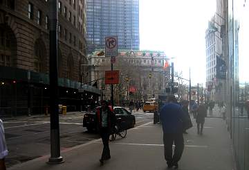
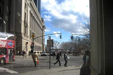
Now “way downtown,”
Reade Street was the northern edge of town in 1765. Cultivated fields or
orchards would have faced the Nugents’ backyard. Farmyard animals for
neighbors! |
This is also the middle block.
Mrs. Williams’ house—and the riot she caused—are imagined
to have been in the far block, which would have been terminated then at the
river’s edge. |
It is almost as difficult to
imagine lower Manhattan being composed of houses as it is of farmland. City
houses were, however, compressed together for overall security. |
||||||
|
|
|
||||||
|
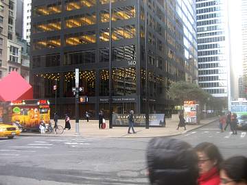
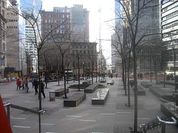
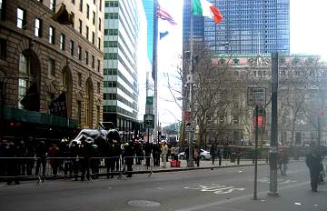
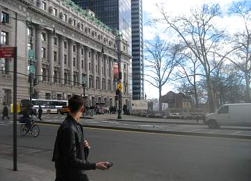
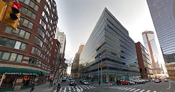
Where I imagined ten elegant
houses, with backyards, separated by an alley, is now one giant skyscraper,
140 Broadway. The streets would have been narrower, the plaza nonexistent. |
Known originally as the Marine
Midland Building, the 51-story tower, built in 1967, is still among the
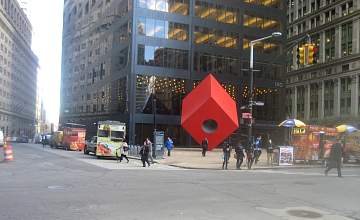
city’s tallest structures. The plaza’s red cube is not an
18th Century artefact. |
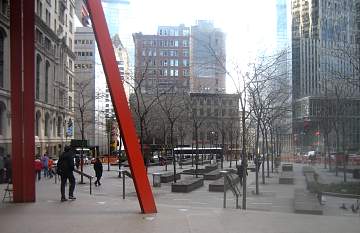
Originally created as Liberty
Plaza Park in 1968, the public space is actually privately owned and
maintained. It is directly across Broadway from the Marine Midland Building. |
||||||
|
|
|
||||||
|
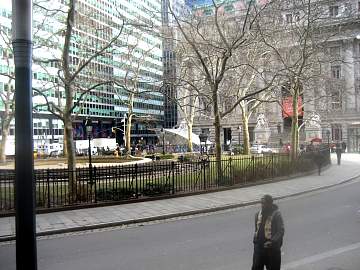
In 2011, the fact of its private
ownership led to its selection as the stronghold of the Occupy Wall Street
movement, which camped out in the park for fourteen months. |
The park was damaged in the 2001
attack, restored, and renamed for businessman John Zuccotti. As zuccotti are Italian desserts, I too
coyly placed Sweet’s public
house on the site. |
When the gardens were created in
1765, Church Street was beyond town. Here we see the east side of Church, from
Duane Street north to Leonard, roughly the location. |
||||||
|
|
|
||||||
|
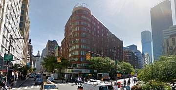
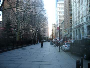
This structure takes up the bulk
of the south side of Murray Street between Church and West Broadway. It was
once home to a building with a green in front that became Columbia
University. |
The locus of many a ticker-tape
parade in the last century, Broadway has been central to New York City events
since the Dutch laid it out. The protests of 1765 repeatedly traversed it. |
In 1765, Bowling Green was the most
coveted residential address of the city. My guess is that the park was
actually a green lawn, and the trees were around the periphery, next to the
houses. |
||||||
|
|
|
||||||
|
The equestrian statue of George
III that once adorned the Green was erected in 1770—in entirely erroneous
gratitude for the king’s supposed efforts against the Stamp Act. |
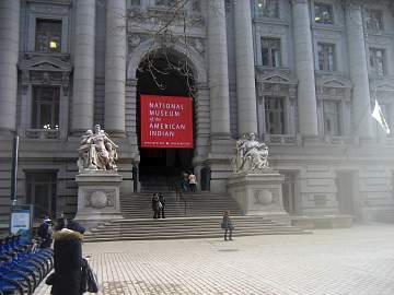
The Customs House/Museum stands
right where the fort used to be. The fort was probably about as high as the
second story windows of the museum, with a single, massive gate. |
The fort had roughly the same
footprint as the Customs House.
It included several buildings. Its sheer walls sloped outward. Trees were
planted along its formidable sides. |
||||||
|
|
|
||||||
|
From the edge of the fort, the
land sloped quickly to the
river—much closer than today. Cannon were at the extreme edge—to batter any enemy warship that got so
far. |
Looking east and south across the
corner of Chambers Street and “the road to Greenwich Village,”
Vauxhall was a briefly-flourishing private park akin to Grammercy Park. |
View from the previous corner,
simply facing the opposite direction.
Included only because of the curiosity that this spot was then the
edge of the Hudson River. |
||||||
|
|
|
||||||
|
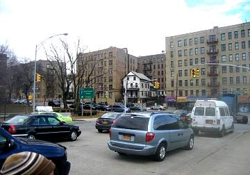
Major Thomas James’ house
was “on the square facing the park.” But the maps don’t
indicate a square. Therefore I placed it on Greenwich Street between Warren
and Murray. |
What is now City Hall Park was an
open public green space, usually called “the fields” in 1765. In
addition to being literally common pasturage, it was ideal for any large public
assembly. |
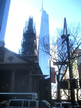
The venerable St. Paul’s
Chapel, which survived the fire of 1776 and the attack of 2001, was not there in 1765. It was built as an
extension of Trinity Church … in 1768. |
||||||
|
|
|
||||||
|
There are probably surveyor’s
plots on file that give a more precise locus for the Kingsbridge that stood
in the vicinity beginning in 1693—until well into the 19th
Century the only bridge. |
When the Channel was created in
the 1880s, the blocks of Manhattan that were suddenly separated by water from
the island and joined to the mainland remained in New York County. |
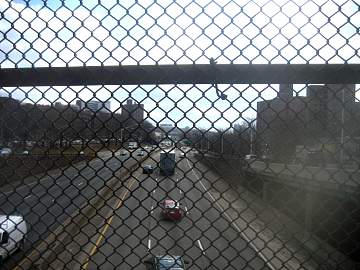
For hundreds of yards, the Major
Deegan Expressway follows the original route of the Harlem River/Spuyten
Duyvil Creek. Large commercial boats could not navigate it. |
||||||
|
|
|
||||||
|
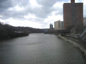
This section is an artificial
canal, a deep, half-mile shortcut created in the same decade that Hell Gate
was widened. The Alexander Hamilton Bridge and New Jersey are in the
distance. |
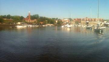
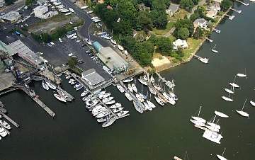
Mamaroneck is like most Long
Island Sound harbors: a creek leading to a shallow tidal estuary. Before
boats had auxiliary motors, only muscle would bring in a boat in adverse
wind. |
Far more conveniently arranged
than anything was in the 18th Century boats, the wharf here is two
hundred yards down a slight slope from the Boston Post Road. |
||||||
|
|
|
||||||
|
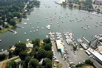
This looks somewhat more open than
it practically is. A cruising yacht that draws a mere six feet needs to
follow a marked channel almost two miles in order to reach deep water. |
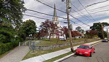
Located at the top of a rise a
hundred yards up East Boston Post Road from the boatyard, the site of this 1859 church is a
logical place to imagine Aaron Colegrove’s family estate. |
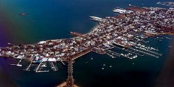
A mile and a half from end to end,
City Island is a charming anomaly: a self-contained village with a
centuries-old history of fishing and boat-building, located in The Bronx, New
York City. |
Photos of sites that were visited in previous novels
of the series:
Notices – Ordering – Author – Contact