IF TWO ARE DEAD Locations Today
Locales
of Jersey City
Click on thumbnails for full-size
|
|
|
|
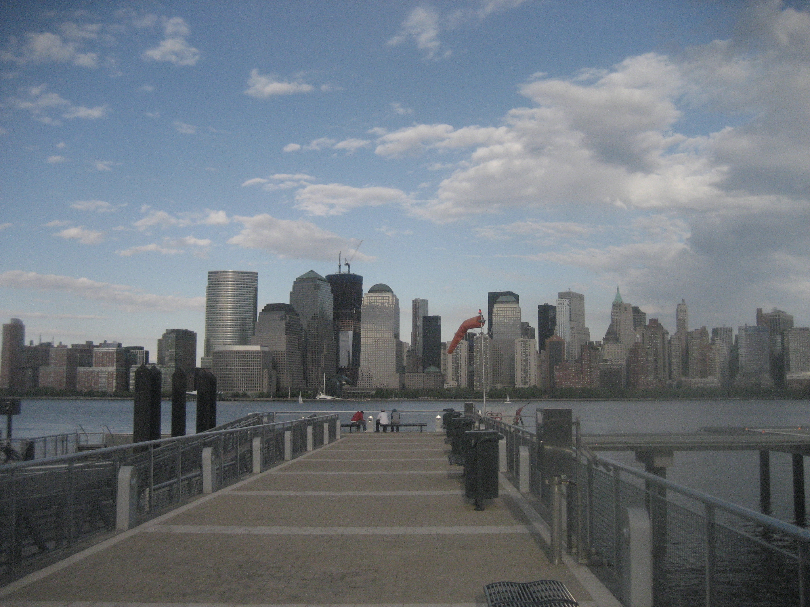
The Manhattan
skyline from the pier of the ferry at Paulus Hook. The Hudson River is approximately
one mile wide here. It would have been somewhat wider in 1762, before a great
deal of landfill had been added on both banks. |
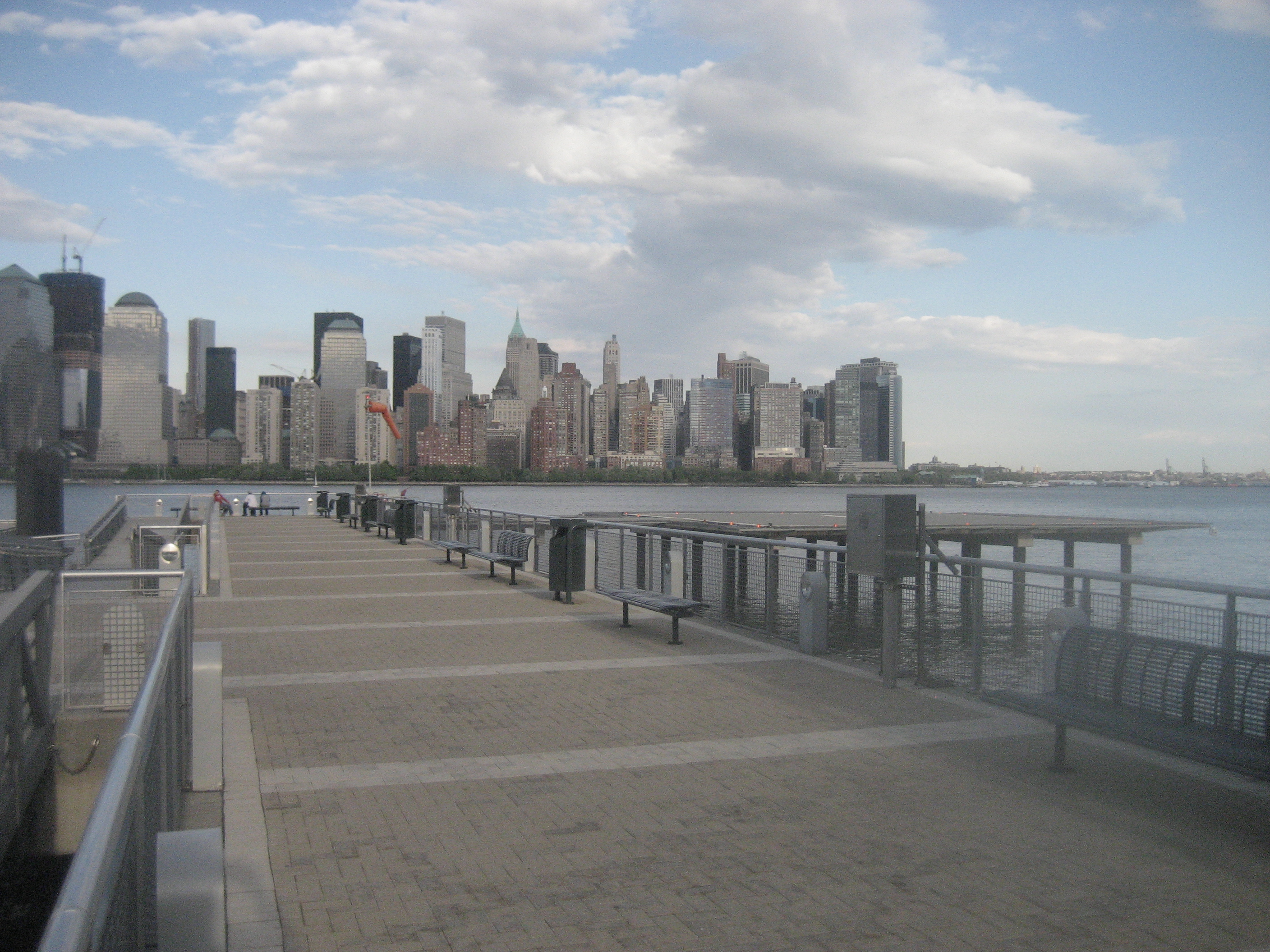
The same, looking
slightly more to the southeast. Trinity Church, no longer visible behind rows
of skyscrapers, and Fort George would have been the primary landmarks in
1762. It’s very difficult to distinguish the southern tip of Manhattan from
Brooklyn beyond it, and Governor’s Island on the right. |
|
|
|
|
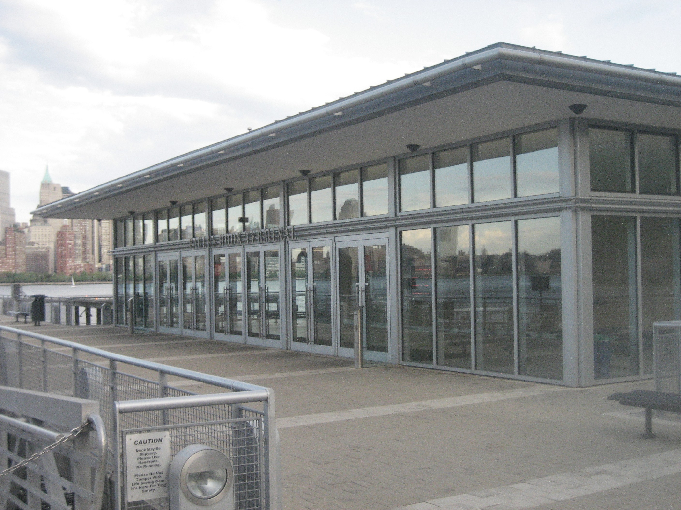
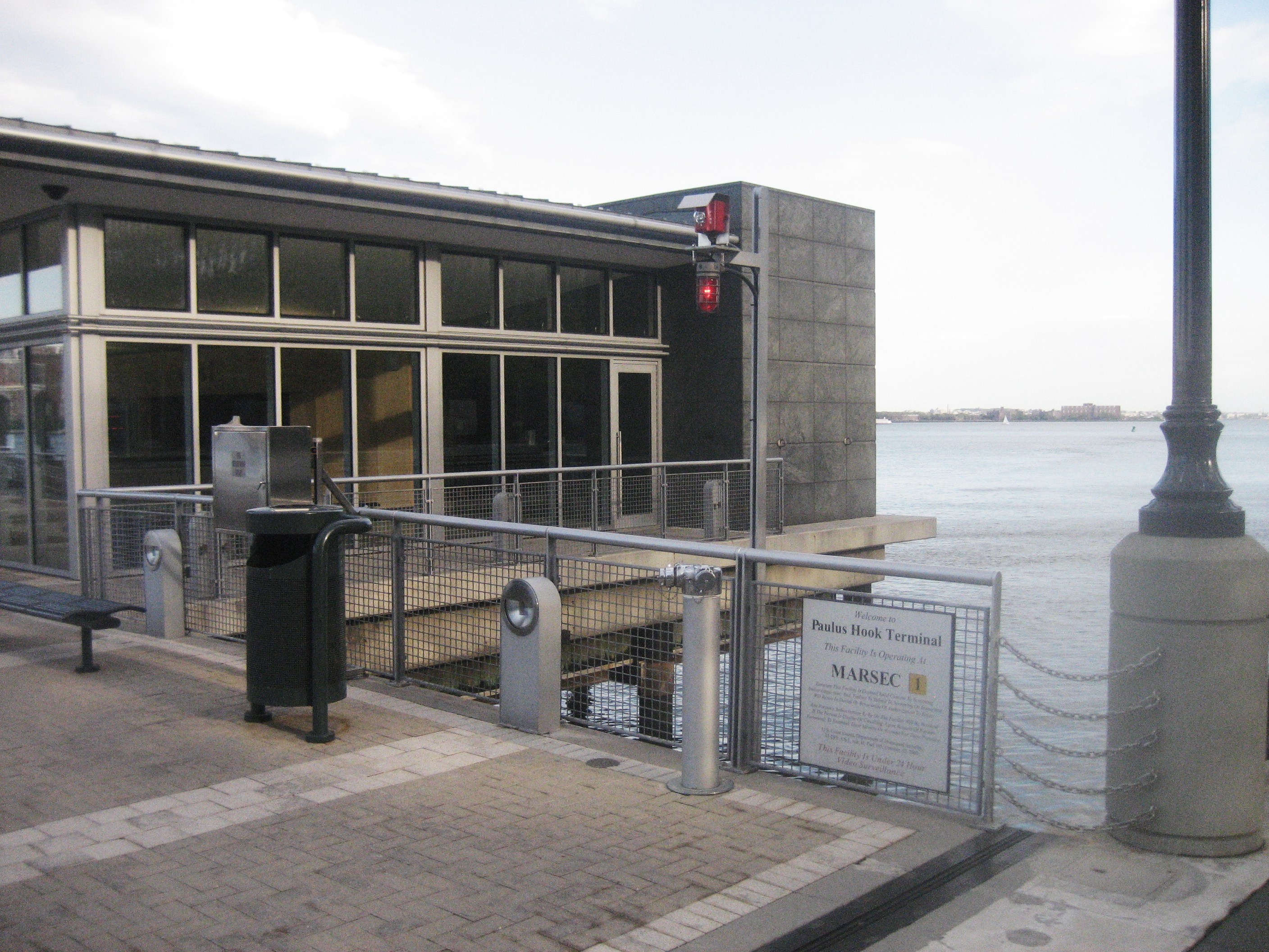
Yes, there is still a Paulus Hook ferry, despite the
nearby proximity of the Holland Tunnel and the PATH trains. In 1762, the
ferry would have been wind-powered, and would have to suspend operation in
the event of too little (or too much). |
It would also be
suspended for weeks each winter as the river iced up. This terminal is
obviously very modern; ferries are coming back to the metropolitan scene as
automotive commuting becomes clogged. |
|
|
|
|
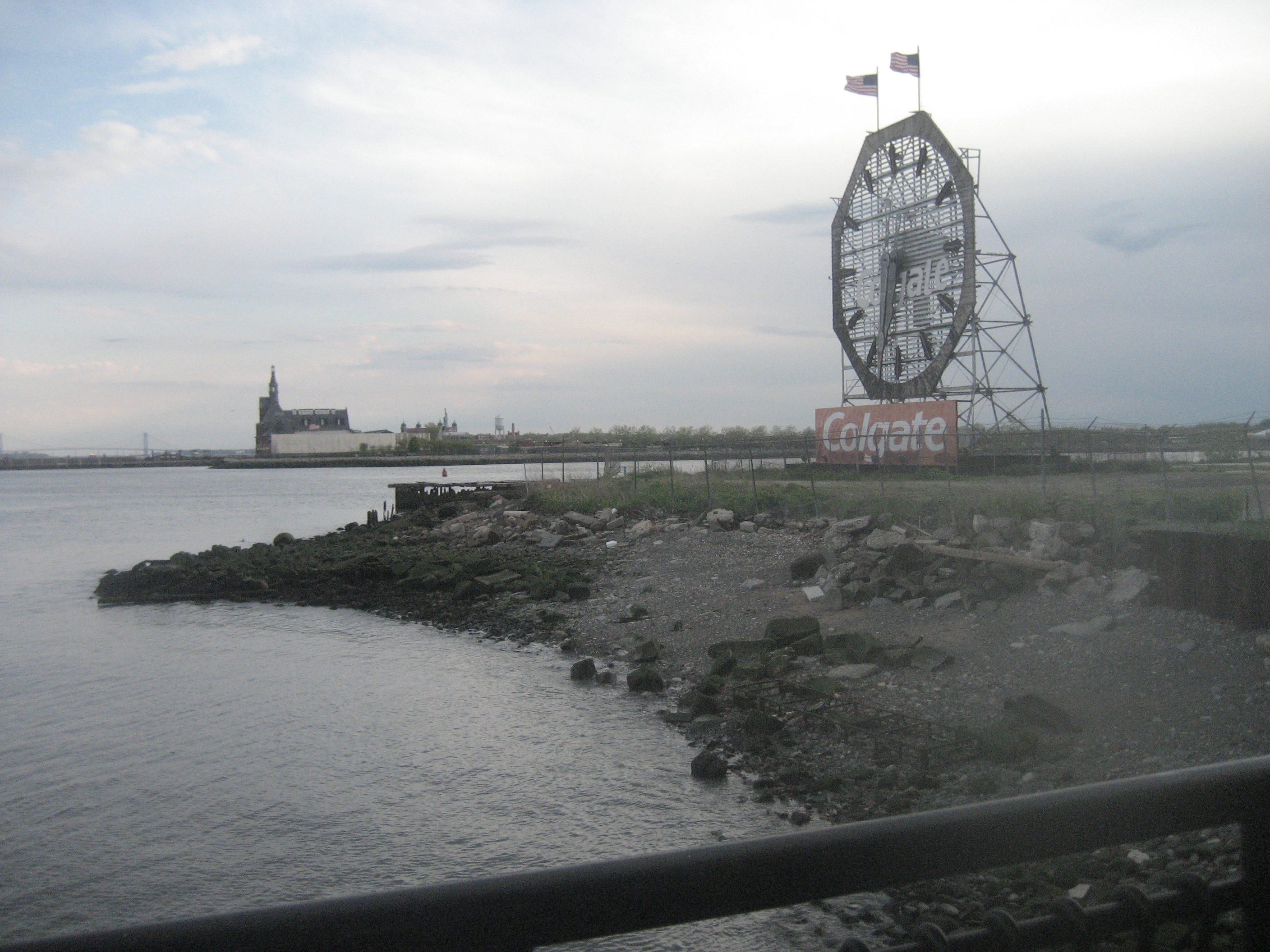
Looking south from
the ferry pier, we can see a great deal of very flat land. Prominent is the
former Communipaw terminal of the Central Railroad of New Jersey (1889). The
bridge in the distance is the Verrazano-Narrows (1964). |
Although this is
landfill, the natural terrain of the Bergen Neck in 1762 would have been a
muddy facsimile. Immediately to the west of the ferry pier, however, is the
42-story Goldman Sachs tower (2004), the tallest building in New Jersey. |
|
|
|
|
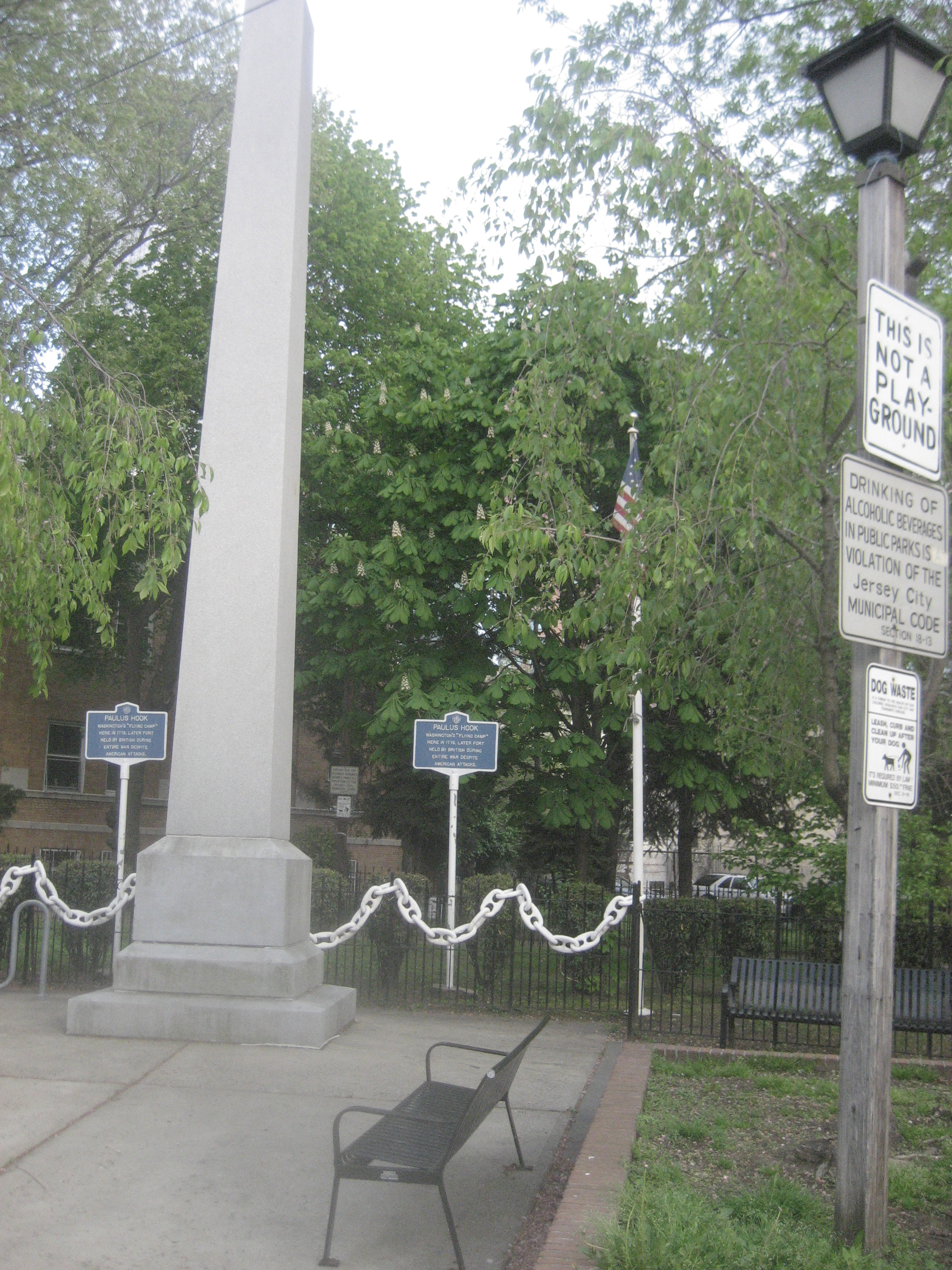
Two hundred yards
west of the ferry dock, tiny Paulus Hook Park is the site of a small fort the
patriots built in 1776. The fort was promptly overrun by the British, but was
the object of a dramatic American raid in 1779. |
Located twenty feet
above sea level—a high point amid the (then) surrounding marsh and swampy land,
this is where we imagine Van Narden’s inn would have been
located. Meed’s disreputable tavern would have been right on the waterfront—perhaps where Goldman Sachs is today! |
|
|
|
|
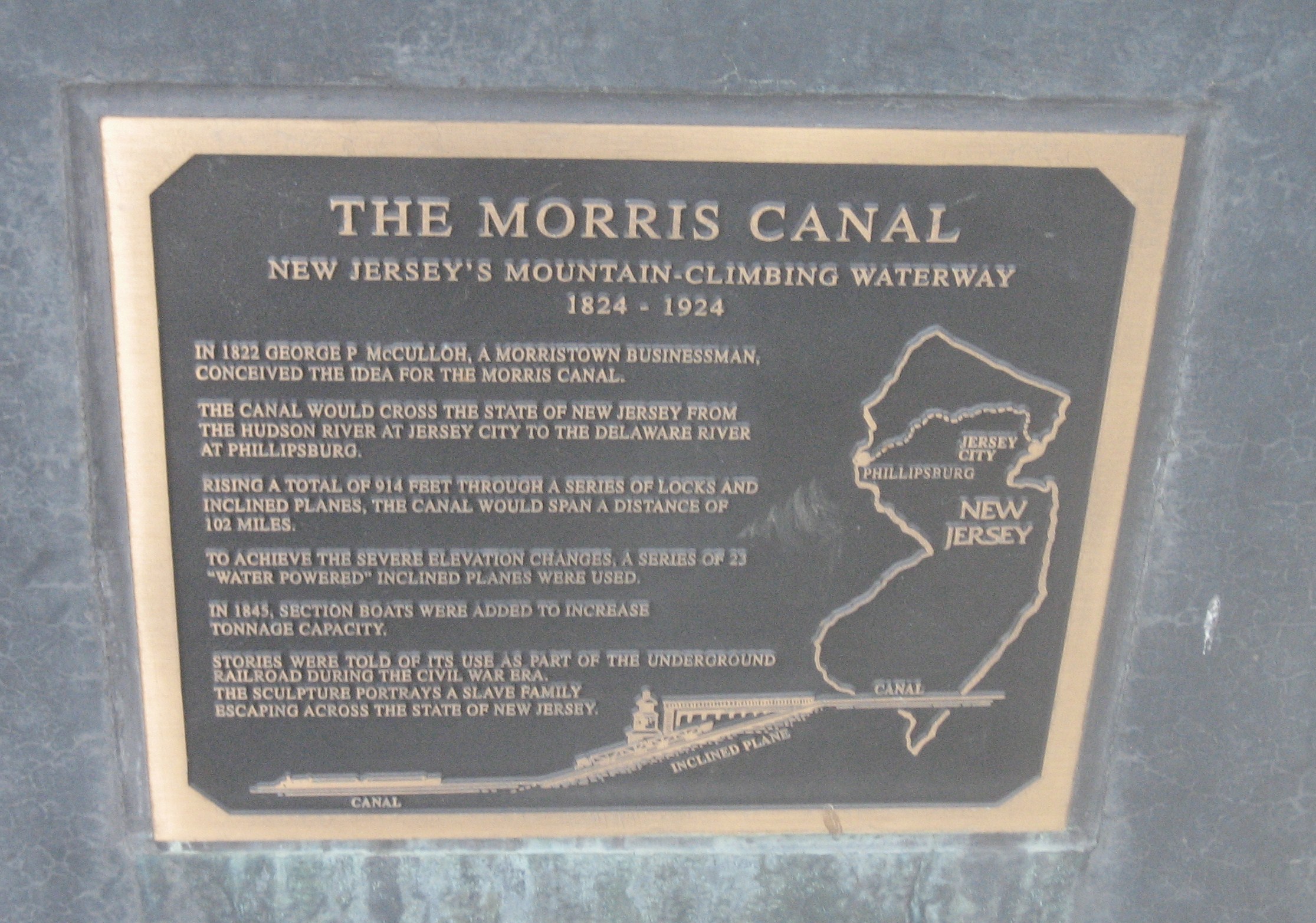
As canals,
railroads, and highways successively supplanted rivers as the primary
commercial conduits to the interior of the continent, Jersey City
(incorporated 1820) grew up as a major transportation hub. The former
terminus of the Morris Canal is one hundred yards from both Paulus Hook Park
and the ferry dock. |
|


Links to contemporary photographs of local scenes:
Notices – Ordering – Author – Contact