Presenting
The Google
Earth Animated Tours!
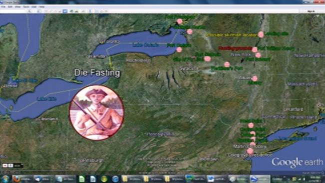
Locales of DIE FASTING
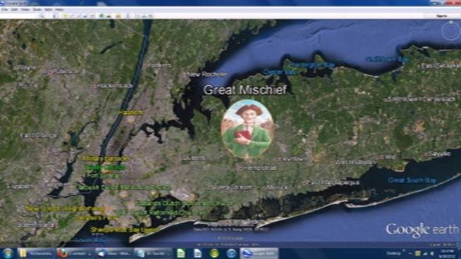
Locales of GREAT
MISCHIEF
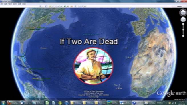
Locales of IF TWO ARE
DEAD
Geography lovers, rejoice! Google
Earth is an exciting free computer
application that smoothly shows you recent satellite photography of everywhere on earth! It allows one to add or subtract details as
needed, and to see the photography from different virtual heights and
angles. Quite amazing!
It also allows one to save one’s private “placemarks,” and to compile a group of placemarks
into virtual "tours," which can then be shared.
Your author was unable to resist creating tours of
his novels as the scenes exist today. Readers who are unfamiliar with Google Earth (and who have the requisite computer horsepower—PC
or Mac—and the broadband internet connection that makes it work fluidly), may
well be delighted to allow their curiosity regarding the books to introduce
them to a 21st Century marvel.
Rest assured, the tours take pains to avoid spoiling the
plotlines of the stories for anyone who hasn't yet read the books!
|
Download Google Earth
(723 KB). A standard installation process will be required. |
Play with it a bit, it’s engaging and fascinating!
Next, download the tours themselves. If uninterrupted,
each animation will take approximately seven minutes to run. (But interrupting it is the idea!)
|
|
Download the (New!
Improved!) DIE
FASTING Tour (108 KB). NOTE where you save the tour on your system! |
|
|
Download the (New!
Improved!) GREAT
MISCHIEF Tour (101 KB). |
|
|
Download the IF TWO ARE
DEAD Tour (240 KB). |
You’re welcome to save these tours to your hard
drive. (They have been created as a “public service.”) However, saving the
files shouldn’t be necessary. If Google
Earth has been fully installed, your system should recognize the files’ *.kmz extensions, and the tours should open Google Earth and run automatically (whether from the Internet or
from your hard drive).
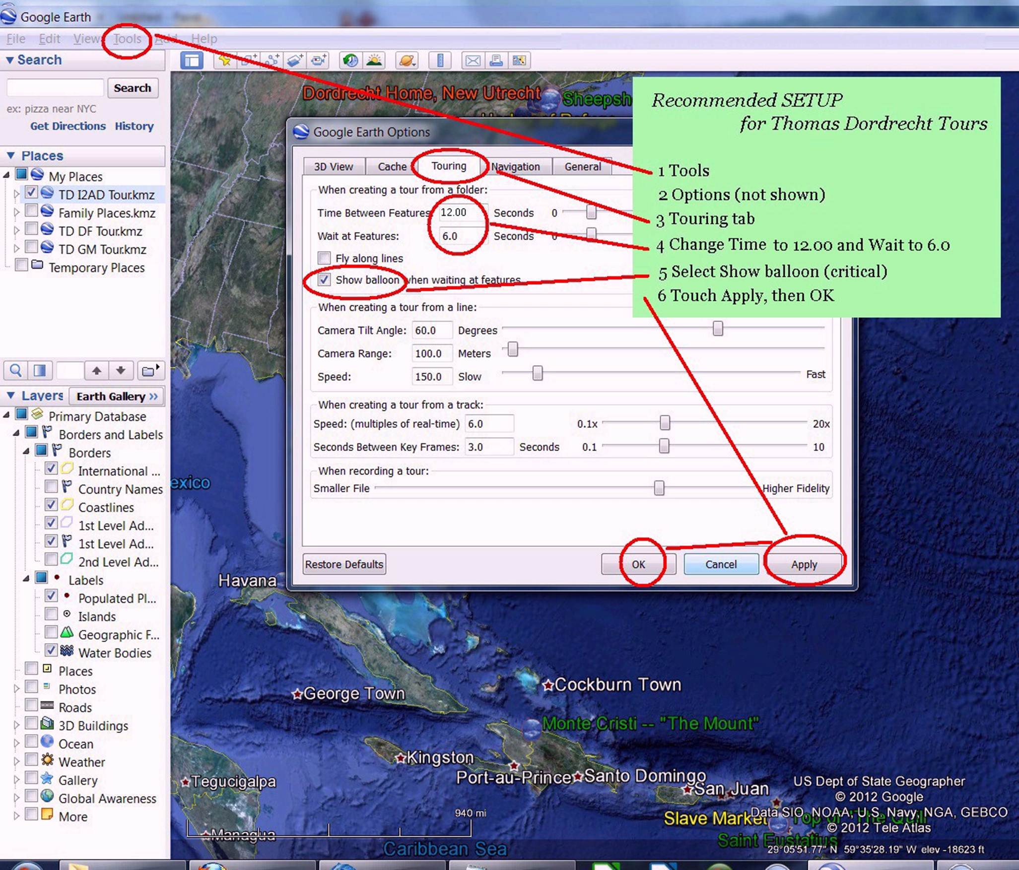
The tours will run at this point. However, by virtue of the defaults of Google Earth, they will not run optimally.
Specifically, too much modern information
will be shown, creating visual confusion. It is recommended that you take a few
minutes to change a few options (which can of course be changed back for other Google Earth applications). Hint:
Windows users can use the Alt-Tab combination to toggle back and forth
between the directions on this page and Google
Earth.
First, set the Touring
Options:
Next, restrict the Places
and Layers to those needed for the tour(s).
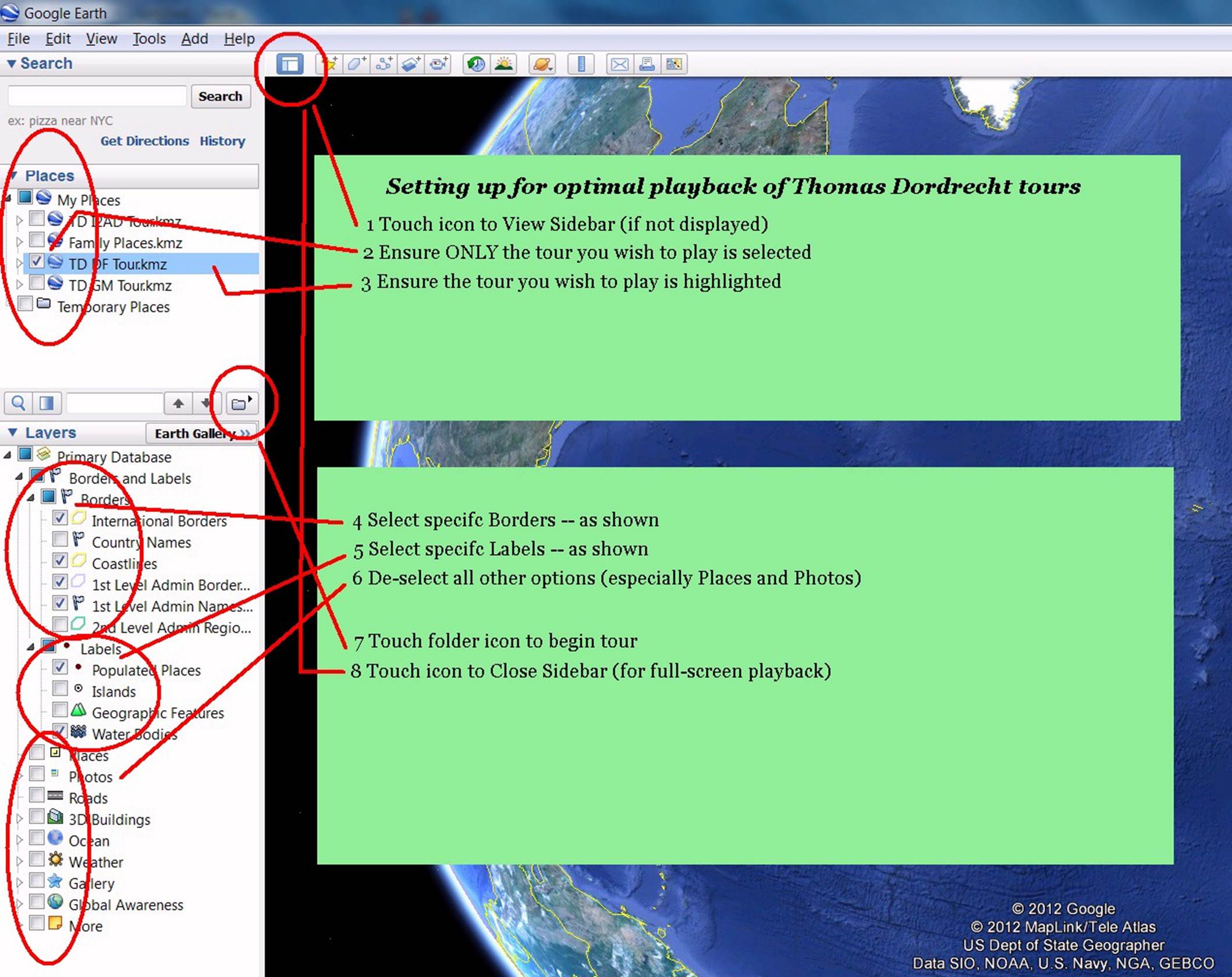
Note that the Layers,
especially, are meant to be toggled on
and off, even as you go to any place or go through any specific tour.
Finally, note these suggestions
for optimal enjoyment of playing back any Google Earth tour:
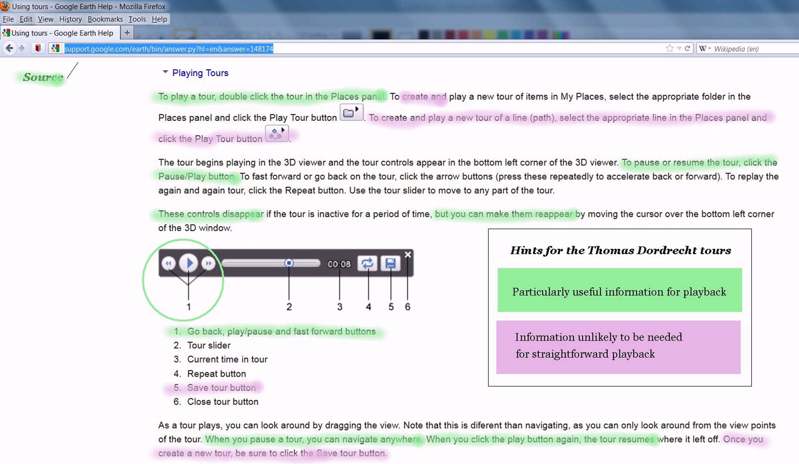
Individuals whose reading speed is no faster than
your author’s will want to keep the mouse cursor hovering over the tour
controls, to Pause the action in
order to finish read the information in the “balloons.” While paused, you can
also investigate nearby locations—or the other side of the globe if you’re so
inclined. Layers can be toggled on and off.
The whole point of Google Earth
is that you can investigate whatever you
find of interest! To resume the tour, hover over the tour controls again, and press Play.
A last note: A simple
convention of the Thomas Dordrecht tours was the following:
|
KNOWN historical sites are named in GREEN |
|
APPROXIMATE historical sites are named in YELLOW |
|
FICTIONAL historical sites are named in RED |
You're on your own from here on out (although I'll
gladly respond to e-mail queries).
JONATHAN CARRIEL
Notices
– Ordering – Author – Contact